This message is intended to share with the academic, federal, and commercial community a number of coordinated activities undertaken over the past year by the Division of Ocean Sciences (OCE) to provide a long-term, stable capability in marine seismic research and development to the U.S. academic research community and federal and state agencies involved with marine seismic research and exploration programs.
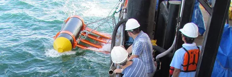
OCE supports a broad portfolio of marine seismic acquisition methods on research vessels of the Academic Research Fleet. The primary seismic acquisition capability used by the U.S. academic community is currently provided by R/V Marcus G. Langseth, a 235-foot vessel owned by the NSF and operated by the Lamont Doherty Earth Observatory of Columbia University (LDEO). On average, the vessel is used by NSF for ~120-150 days per year, with funding from NSF at ~$14M per year, including technical support and equipment.
Operating R/V Langseth has presented financial challenges for many years. Nonetheless, NSF is committed to supporting marine seismic research of high national interest, and will continue to accept proposals for experiments that require capabilities such as those currently provided by the R/V Langseth. As part of OCE's reply in May, 2015, to the National Research Council's report "Sea Change: Decadal Survey of Ocean Sciences, 2015-2025" (see links provided below), and via multiple outreach opportunities over the past year, however, NSF has made clear that the current business, financial, and resultant operational model for R/V Langseth is unsustainable. Contractual obligations and current research commitments are continuing to move forward using the vessel. Beyond early calendar year 2018, however, a different business, financial, and/or managerial model needs to be implemented or NSF/OCE is likely to divest from R/V Langseth and the vessel would no longer be available to researchers.
OCE, in collaboration with stakeholders such as the University-National Oceanographic Laboratory System (UNOLS) and LDEO, has engaged in a variety of activities over the past year to coordinate with and be informed by the community's needs and aspirations regarding the future of marine seismic research. OCE's intent is to use the information gained by these activities to develop a strategy that serves the needs of as much of the academic community as possible, and in a financially stable way. In addition to various meetings, including with LDEO leadership, these activities fall into the following categories:
Regional Framework Plan
As announced in Summer 2015, OCE has adopted a Regional Framework Plan (see link below) for marine seismic data acquisition. The plan currently maps areas of operation through 2019. Future areas of operation will be identified based on community interest. The regional framework is designed to reduce overall data acquisition costs, provide guidance about when to submit proposals for research in a particular area, encourage investigators (both U.S. and potential international teams) with new ideas to submit a proposal that could mesh geographically (e.g., modest transit), and provide rotating access to all regions of scientific interest within a timeframe of several years.
Marine Seismic Workshop
On September 30 and October 1, 2015, a group of 39 scientists, engineers, seismic industry experts, and Federal agency representatives came together for a 1.5 day workshop to discuss future possibilities for marine seismic data acquisition by the U.S. academic research community. The workshop was conceived as a follow-up to NSF/OCE's reply to the Sea Change report mentioned above.
The workshop was designed to consider two primary possibilities that had been proposed as potential options for maintaining the U.S. seismic acquisition ability, while reducing cost. Participants addressed the feasibility of: (a) Acquiring a "portable system" that when needed could be installed on Global-class vessels currently in the Academic Research Fleet, and (b) Contracting with industry to acquire seismic data with their vessels on an "as needed" basis. Portable systems that were considered were those capable of crustal scale imaging, and would not overlap in imaging capability with existing short offset 2-D portable systems at Scripps Institution of Oceanography and portable 3D P-cable systems. The workshop recommendations as well as presentations and summaries of discussions can be found in the report (see link below).
UNOLS Seismic Survey
The UNOLS Office recently undertook a community survey (see link below) that was designed to assess current priority areas in marine geophysical research and the breadth of the communities in the marine geosciences and affiliated fields that collect and/or use marine seismic data. The survey was promoted through the UNOLS website as well as multiple community bulletin boards and listservers. The results are being used to help identify the instrumentation and methodologies that are critical to answer current science questions and also those that are necessary to meet the requirements of future science directions. The survey closed on July 1, 2016, and UNOLS and NSF will be considering the feedback over the coming weeks.
UNOLS Advisory Committee
At the UNOLS Council meeting held in Woods Hole, MA, in May 2016, NSF engaged the UNOLS leadership in a discussion of enhancing the scope of UNOLS' involvement with marine seismic facilities oversight. As part of this enhancement, NSF suggested to the UNOLS Council that the Marcus Langseth Science Oversight Committee (MLSOC, see link below) could have its mandate broadened to become the Marine Seismic Oversight Committee (MSOC). The proposed terms of reference for this new committee are to: (a) Develop an ongoing mechanism for regional planning to inform NSF on research priorities based on U.S. community input, (b) Act to engage and coordinate international participation and to identify international resources that might be available to U.S. researchers, (c) Provide outreach tools and a feedback mechanism to the community, (d) Assist in identifying emerging directions in marine seismic studies, and (e) Promote the engagement and training of the next generation of marine seismic researchers. Aspects of this discussion are likely to be informed by the "UNOLS Seismic Survey" discussed above, and NSF looks forward to ongoing discussion with the UNOLS Council about this aspect of marine seismic planning.
Marine Seismic "Dear Colleague Letter"
OCE has recently issued a "Dear Colleague Letter" (see link below) seeking written expressions of interest regarding new financial and/or managerial models that would provide the marine seismic capabilities to meet the expected needs of academic research scientists. The DCL is part of OCE's effort to develop a long-term, stable seismic capability, and expressions of interest may or may not involve to varying degrees R/V Langseth. Responders are asked to provide their input by November 11, 2016. Please refer to the DCL itself for further important information.
To conclude, and as noted in OCE's reply to Sea Change, NSF is committed to marine seismic research and will continue to support the capability to conduct seismic research of high national interest. OCE thanks the community for their efforts and interest in helping us achieve this goal.
Sincerely,
Richard W. Murray, Division Director, Ocean Sciences
Donald Rice, Section Head, Marine Geosciences
Candace Major, Lead Program Officer, Marine Geology and Geophysics
Bob Houtman, Section Head, Integrative Programs
Links To Referred Documents
- NRC "Sea Change: Decadal Survey of Ocean Sciences, 2015-2025"
- NSF-OCE reply to "Sea Change"
- Regional Framework Plan
- Marine Seismic Workshop Report
- UNOLS Seismic Survey
- Marcus Langseth Science Oversight Committee (MLSOC)
- Marine Seismic "Dear Colleague Letter"